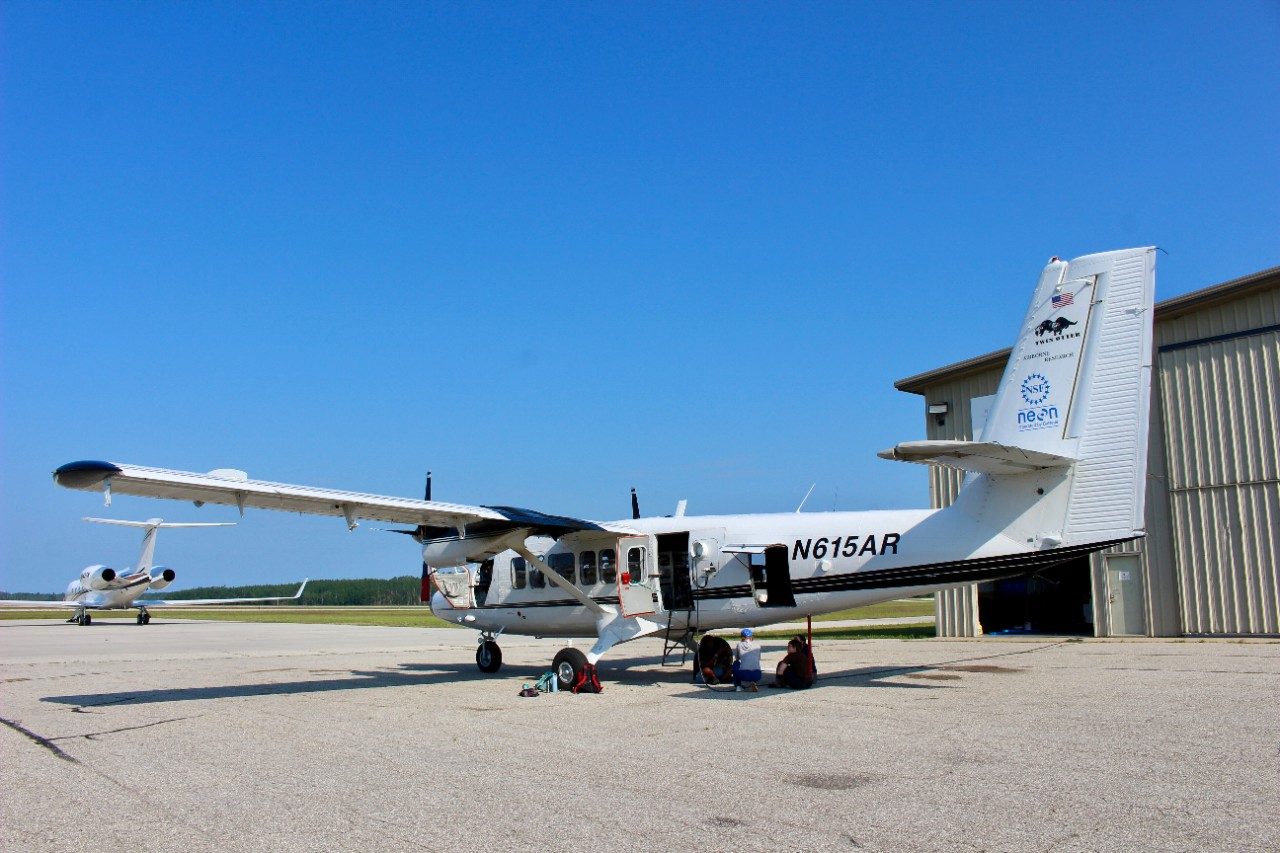
PELLSTON, Mich. — A remote sensing survey of the University of Michigan Biological Station’s more than 10,000 forested acres on a sunny August day followed a pattern much like mowing a lawn.
The plane, a Twin Otter aircraft, flew low and slow — 1,000 meters off the ground at 97 knots — through a layer of haze from Canadian wildfire smoke and a spattering of cumulous clouds to capture a “treasure trove” of data.

Outfitted with 800 pounds of a unique combination of state-of-the-art research instrumentation, the Colorado-based plane leased by the National Ecological Observatory Network (NEON) Program to serve as its Airborne Observation Platform (AOP) is helping UMBS researchers tell the ecological fallout story of a historic ice storm nearly five months prior that devastated northern Michigan.
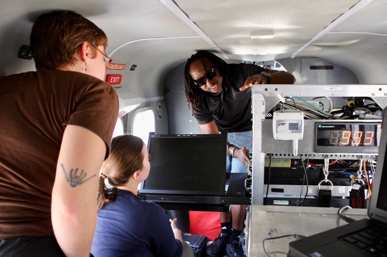
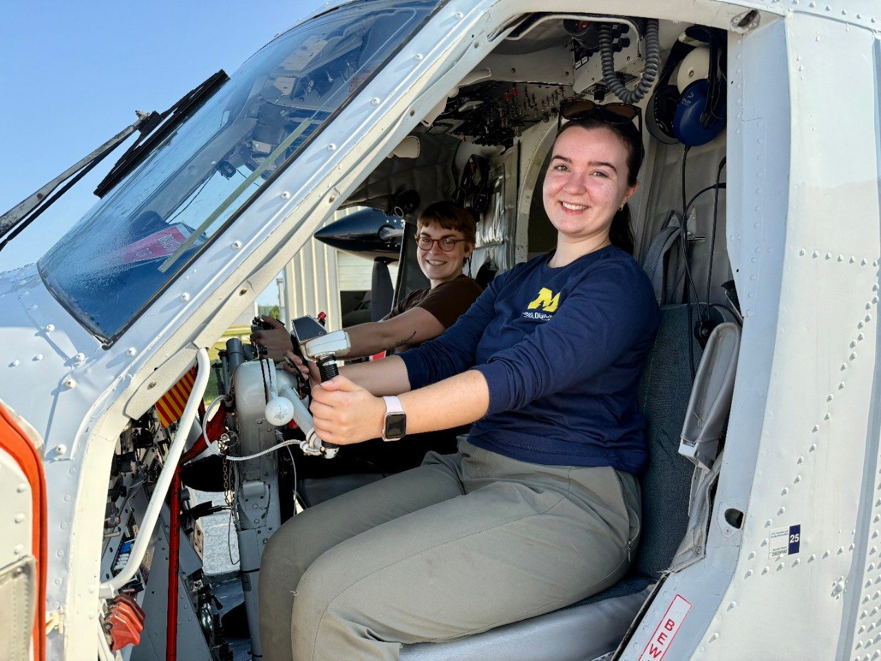
“My uncle didn’t have power for a week during the ice storm, so I’m glad researchers in Michigan are working on this,” said Elissa Barris, one of two airborne sensor operators on board the NEON AOP flight over UMBS.
Barris is from Traverse City and has a background in geophysics from Michigan Technological University.

She spent several days this summer back in northern Michigan based out of the Pellston Airport working on the remote sensing survey assignment with the two pilots of the plane and Cameron Chapman, the sensor operator technician leading the flight data collection.
The quartet travel the country conducting aerial surveys on a plane carrying a 12,500-pound payload, including enough fuel to fly for about four hours at a time. The powerful data-gathering instruments include a hyperspectral imaging spectrometer, a full waveform lidar sensor, and a high-resolution camera.
“I've been doing this for over 13 different flight seasons and it's a new adventure each time,” said Chapman, a native of Chicago who went to college in Alabama. “Here in northern Michigan, I’m surprised by how warm and humid it is. But locals have been telling me stories about this past winter.”
Lasting several days, an ice storm in late March downed trees and power lines, leaving thousands without power and roads impassable. Gov. Gretchen Whitmer declared a state of emergency for ten counties including Cheboygan County, where UMBS is located, to help with response and recovery efforts.
Fast forward to Wednesday, Aug. 13, the nearly three-hour flight soaring over the canopy of trees at the research and teaching campus in Pellston between Burt and Douglas Lakes serves as a complement to on-the-ground data collection by a UMBS research team led collaboratively by Dr. Robert Fahey from the University of Connecticut and Dr. Christopher Gough from Virginia Commonwealth University.
Each summer the team lives and works at UMBS.
Their 2025 project is funded by the National Science Foundation (NSF) through a RAPID grant, which is designed to assess the impacts of natural disasters.
The RAPID grant provides funding to unravel consequences of disturbance interactions in forests, which are increasing as a result of climate change. Data collected include terrestrial lidar scans, canopy, subcanopy, and seedling censuses, photosynthetic active radiation (PAR) measurements, and the amount of woody debris as a result of disturbance. These data give insights into the changes in structure and production of disturbed forests over time.

“We’ve been doing a lot of measurements on the ground and looking at the canopy from below,” said Iris Kennedy, a graduate student researcher from the University of Connecticut who is running the field crew at UMBS for the project. “With NEON’s team flying this plane overhead, we’ll be able to get a new and bigger perspective on the ice storm. I'm excited to pair the ground-based measurements with these super high-tech measurements from above.”
They have a strong base in terms of knowing what it was like before the ice storm.
Armed with more than a century of the field research station’s place-based ecosystem data and a pre-ice storm baseline picture from a 2019 NEON flight to compare the new aerial-gathered measurements, the team of forest ecologists at UMBS hit the ground running at the start of the 2025 field season to assess ice storm damage in previously disturbed and “undisturbed” forests, analyze how interacting disturbances impact forest resilience to this type of natural disaster, and help inform forest management in the future.

Though they have yet to dig through the results of the new, high-tech data from the NEON AOP flight survey, the researchers are seeing an initial anecdotal picture arising from their groundwork that shows a species-specific effect for trees.
“Certain species are more vulnerable to ice storm damage like the pines and the aspens. Aspen will bend and snap. Pine just snaps,” Kennedy said. “The older forest — the more late-successional forest — seems to have been able to resist damage better, which is really interesting. The data gathered from the plane will really give us a scale of what the ice storms did in the UMBS forests, which include experimentally disturbed plots — some vary in disturbance severity, some vary in time-since-disturbance, and some are controlled or untouched.”
Erin-Darby McClain, a field researcher on the project and a recent graduate student in the Gough Lab at VCU that focuses on carbon cycling processes, is eager about hyperspectral data and full waveform lidar data gathered from the August flight to comprehensively pinpoint changes in vegetation patterns and canopy chemistry.

“I am super jazzed about this image spectrometer and the hyperspectral data that they can collect from it because that's a huge emerging topic in the remote sensing world,” McClain said. “That spectrometer is an $800,000 piece of equipment. It’s amazing we have access to it through the collaboration between the University of Michigan Biological Station and other universities. And we're able to use it to do an assessment that’s relevant to a lot of people in this area who lost power and worked hard to clean up trees that fell on and around their homes.”
The “very sensitive, but very powerful” spectrometer is heavy — the sole reason behind needing such a large plane — and requires 24-hour power to keep it cool.
Designed and built by NASA’s Jet Propulsion Laboratory, the hyperspectral imaging spectrometer can gather all sorts of information about how healthy the plants are, what types of species it’s looking at, and how photosynthetically active they are.

“As we fly over a line, it’s capturing sunlight that’s hitting plants and reflecting back into the instrument,” Barris said. “Inside that chamber, we have a series of lenses and mirrors that are focusing that light into our focal plane array, which is then able to measure the light returning in each different wavelength band, going all the way from infrared through the visible spectrum into UV.”
A high level of precision is required in the lenses and mirrors that are refracting and reflecting everything in the chamber because so many different bands of light need to be separated out.
“If those lenses and mirrors warp at all or expand with temperature, they lose their accuracy,” Barris said. “The machine is also under a vacuum to help it stay cold and to prevent contamination and water vapor from getting on those surfaces and affecting the measurement.”

One of the other research instruments on board the plane is a lidar sensor, which stands for Light Detection and Ranging. Lidar uses reflected light to capture surfaces either from above (airborne) or below (terrestrial).
Of the different kinds of lidar sensors available for research, NEON uses what’s referred to as full waveform, which the airborne sensor operators said is gaining popularity in the science world.
The lidar shoots a laser down at a fast rate and measures the return time for each pulse.
“When the pulse of light goes down to the ground, most lidar sensors will capture a midway point. They'll capture when it hits a target, like canopy top, or the ground, maybe, and then comes back up,” Chapman said. “But full waveform captures the full length all the way down and all the way back up.”

Each of those pulses can hit up to four or five different surfaces and still send a partial return signal back. That means the instrument gets a return signal when it hits the top of the tree, another return when it hits a branch and then the ground.
The lidar sensor is critical for gathering topography and canopy elevation.
“We can actually map individual trees with that and look at how many trees are growing, what types of other ground vegetation — the understory,” Barris said. “Between that and combining that information with the hyperspectral photosynthetic activity, we can really start to see how many of which species are down there and how everything is doing.”

The flight path is important. The pilots follow 10-kilometer-by-10-kilometer flight boxes. They fly one line, which takes up to five minutes, turn around, and then fly the next line. All lines are north and south, followed by one east-west crossover line to spatially connect all of the data.
On top of the aircraft are two antennas — one for the lidar and one for the spectrometer.
The pilots restrict how much they tilt their wings, known as the bank, to 25 degrees so the antennas don’t lose their lock with satellites.
“Typically, you need at least four to eight satellites to get good data, which is not a problem for down here in the lower 48,” Chapman said. “The challenge is in Alaska where you're barely getting five satellites because they're already so low on the horizon.”
For the UMBS research team, this project has forest management implications.
“What we learn won’t prevent ice storm damage, but we can give an idea of just how bad it can get or how to better prepare your property to try to avoid such devastating impacts to families and their homes,” Kennedy said. “In this day and age where there are more frequent and intense disturbances, this is the start of the journey to hopefully mitigate these disasters in the future.”

McClain called it a privilege to have access to such a wealth of information through UMBS research infrastructure and historic datasets, as well as from the NEON flight survey in mid-August. Such insights into the structural and production changes of a forest over many years across a large landscape are hard to come by, and long-term research conducted at UMBS provides a unique look into these changes.
As the field season comes to a close, Kennedy’s intensive analysis work begins.
“I wish I had answers already for the people who are asking, ‘What happened from the ice storm?’” Kennedy said. “We have all this data, but we don't know the full story yet. I can't wait to share it with them once we have it.”

To learn more about NSF NEON Airborne Remote Sensing, go to the NEON website.
Watch the NEON video to see how the on-board research equipment works.
The University of Michigan Biological Station — the largest of U-M's campuses — is one of the nation's largest and longest continuously operating field research stations.
Founded in 1909, the Biological Station supports long-term research and education. It is where students and scientists from across the globe live and work as a community to learn from the place.
The University of Michigan Biological Station serves as a gathering place to learn from the natural world, advance research and education, and inspire action. We leverage over a century of research and transformative experiences to drive discoveries and solutions to benefit Michigan and beyond.
Subscribe to the UMBS monthly e-newsletter and follow the field station on LinkedIn, Instagram, Facebook, YouTube and X (formerly Twitter).