In the midst of all my posts about life in Sudan, we have been doing our magnetometry survey. We’ve spent as much time as possible in the field, and it’s taken a couple of days to find time to pull all the data together. But the great news is that we are getting results!
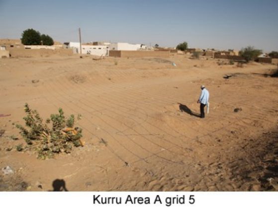
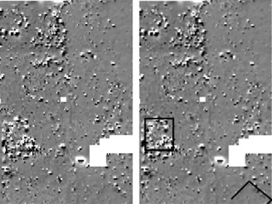
Dr. Mohammed and his team have finished an area of 76 x 40 meters after about 2 days’ work (after our false start). They lay out grid lines and he walks along each string at a measured pace and with the magnetometer (the white machine in his hand) takes the right number of readings. They then download the data and plot it. The white areas on the plot are areas of no readings (the biggest of these is because of two thorn trees that we didn’t cut down), and the black pixels are high magnetic readings. It’s the differences that are the most important.
We are going to focus our efforts on two particularly promising areas. One is a diagonally oriented building in the lower right corner, and the other is a stronger anomaly in the center left of the plot, which is where the people in the village remember the “royal bath” excavated by Reisner to be. It will be exciting to rediscover this feature, but even more exciting to excavate around it to see what it belongs to.
The apparent difference in orientation is interesting. Everything here is oriented to the Nile. The people in the village even designate north as the direction of the Nile flow. That works pretty well for most of the Nile’s course, but we’re in a stretch of the river where the Nile flows southwest, so it can be confusing. But the edge of the palm grove lines up with the river for the most part, as do the houses and roads in the village. So a different orientation could point to a different historical period when perhaps the Nile course varied slightly. We’ll see!