This story was updated to reflect data gathered by the buoy during the solar eclipse on Monday, April 8, 2024.
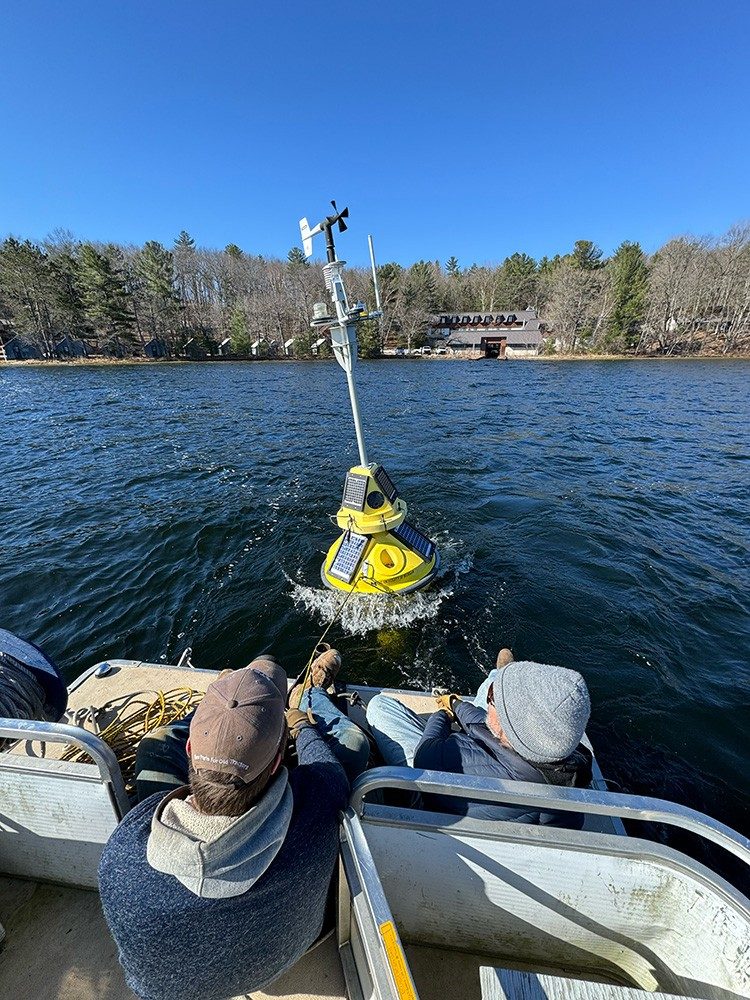
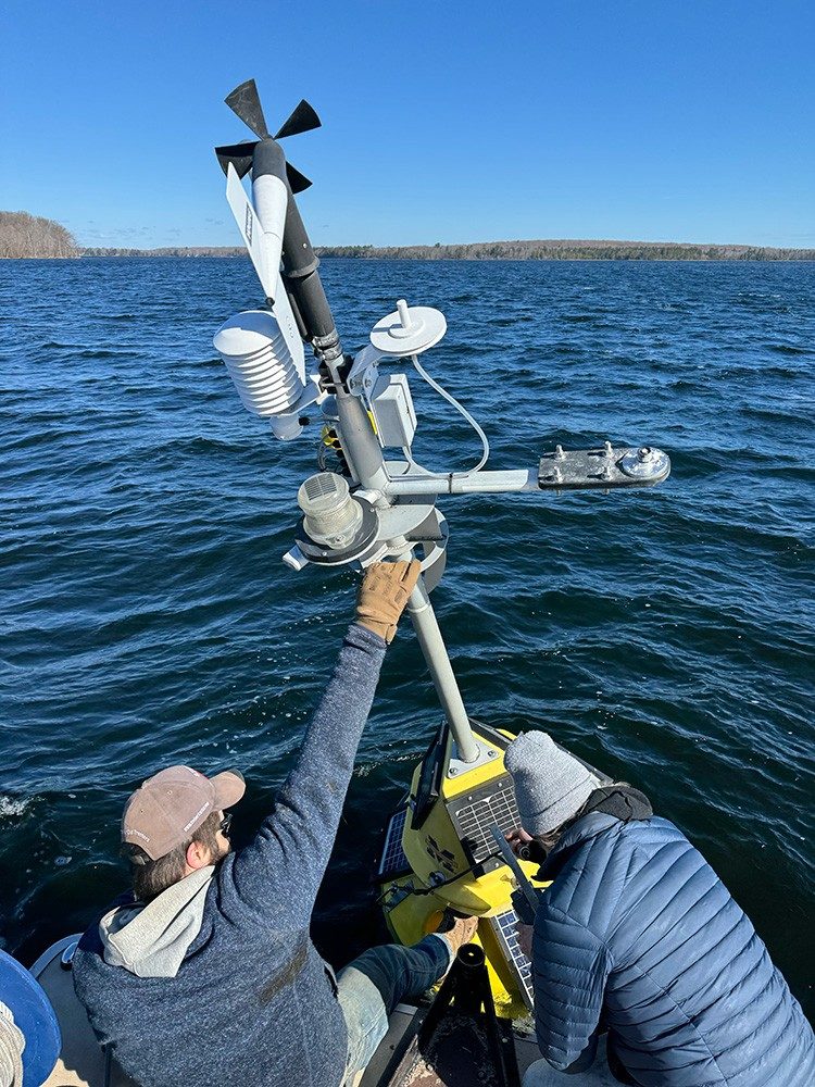
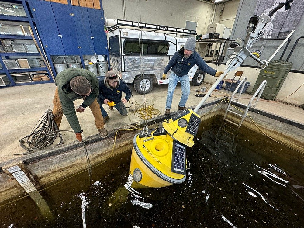
PELLSTON, Mich. — The University of Michigan Biological Station deployed its floating laboratory in Douglas Lake on Friday, April 5, 2024 — the earliest since the field station added the device to its arsenal 14 years ago.
The earliest previous deployment was April 18, 2012.
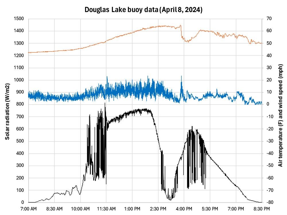
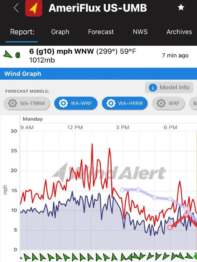
Scientists tracked changes during the solar eclipse on Monday, April 8, using the UMBS Buoy Dashboard. They primarily looked at changes in radiation, wind and air/water temperature when the Moon passed between Earth and the Sun.
The UMBS buoy measured a 12-degree Fahrenheit drop in air temperature, taking roughly an hour to recover. Data show a big drop in sunshine (eclipse + clouds) Monday afternoon with weakening wind, remaining less gusty into that evening after a burst of wind coming out of the eclipse. (See graph below story.)
The 150-foot UMBS AmeriFlux Tower also measured a decline in wind speed and much more variable wind direction during the solar eclipse. Data show the burst of wind coming out of the eclipse likely came from a different direction. (See graph below story.)
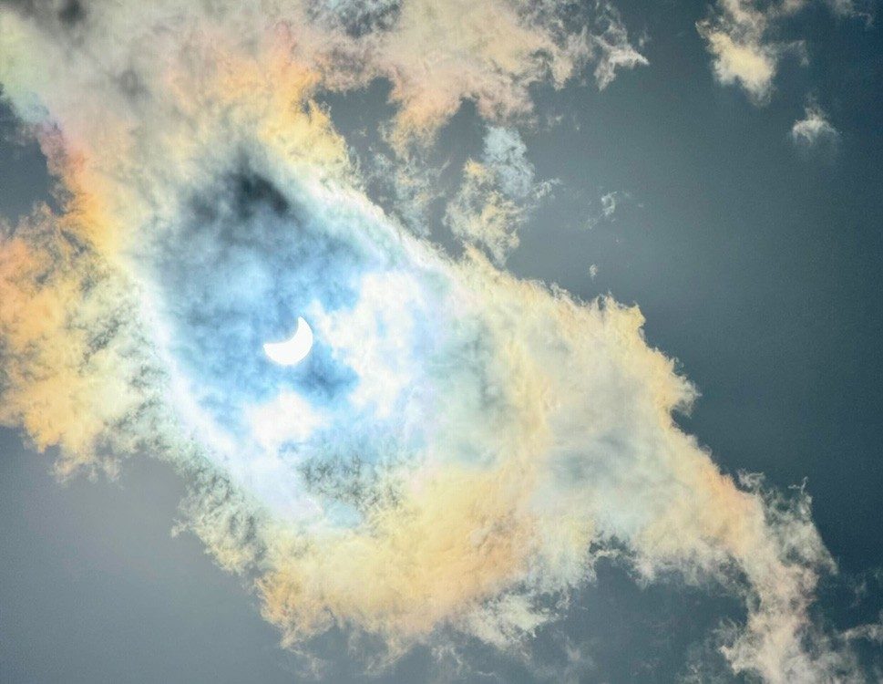
Dr. John Lenters, senior research specialist, said the temperature drop was likely from cold air that had pooled over the lake during the calm winds, but also air that had been cooling over land. Due to thick clouds at Douglas Lake, John fled to Cheboygan for clear sky and shared a photo he shot post-peak. (See photos below the story).
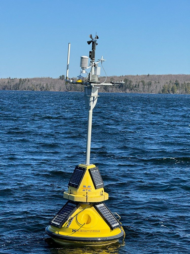
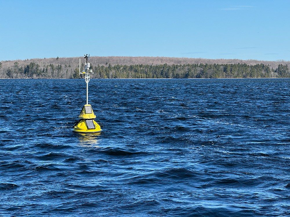
The smart buoy has become an annual landmark in the northern Michigan community, floating 24-7 in all weather conditions during the spring, summer and fall to monitor water quality and help us understand and protect our freshwater resources.
It is one of only a few buoys in the Great Lakes Observing System’s (GLOS) network stationed on an inland lake, rather than one of the Great Lakes.
Scientists at the northern Michigan field station deployed the device in Douglas Lake’s second deepest spot — a glacial kettle hole about 22 meters deep, or 72 feet, in South Fishtail Bay — to capture a full water column spectrum of data, from top to bottom.
The buoy carries a solar-powered sensor that provides real-time measurements remotely accessible to scientists and the general public — including fishermen and boaters — to help track water conditions.
You can see the buoy from the shore of the U-M Biological Station, where students, faculty and researchers from around the globe have studied and monitored the impact of environmental changes on northern Michigan ecosystems for 115 years.
The buoy bobbing in the bay is equipped with what is called the YSI 6600 sonde, an instrument consisting of several probes to measure various water quality parameters, including how much blue-green algae are present, water temperature, clarity, oxygen levels, turbidity and pH.
The University of Michigan Biological Station has been home to scientific discovery since its founding in 1909. Our core mission is to advance environmental field research, engage students in scientific discovery and provide information needed to understand and sustain ecosystems from local to global scales. In this cross-disciplinary, interactive community, students, faculty and researchers from around the globe come together to learn about and from the natural world and seek solutions to the critical environmental challenges of our time.