Field Guide
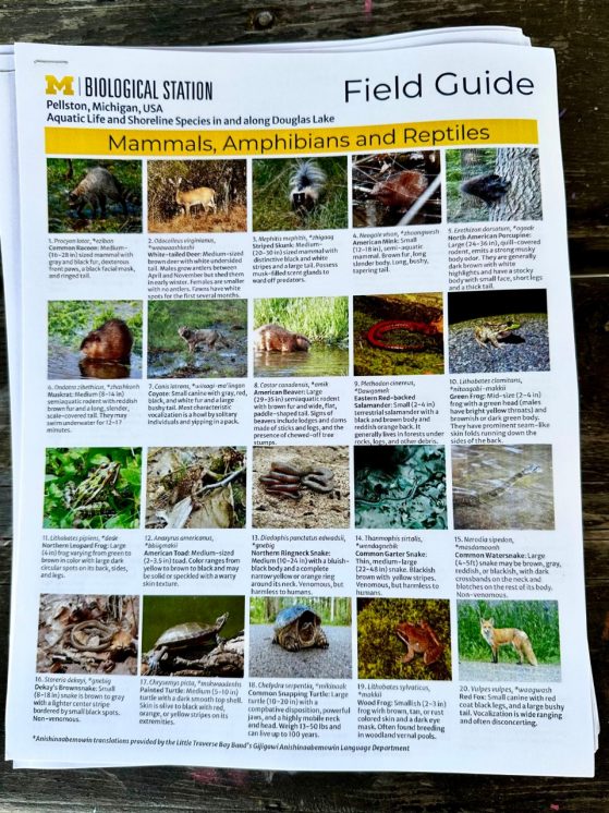
To educate the community about the biodiversity in their own backyard and inspire neighbors on their journey through the natural world, UMBS created a field guide to serve as a reference to help identify the aquatic wildlife and shoreline species in and along Douglas Lake. The field guide was informed by UMBS scientific experts, visiting researchers and private local citizens during a three-day BioBlitz in 2023 that tallied the living things that call this part of northern Michigan home.
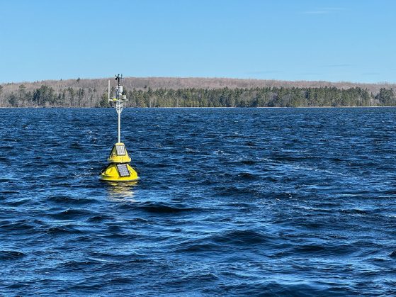
UMBS Buoy Dashboard
Access live data 24/7 in the spring, summer and fall from the floating laboratory on Douglas Lake that scientists use to monitor water quality and help us understand and protect our freshwater resources. The smart buoy is deployed each year in a glacial kettle hole about 22 meters deep, or 72 feet, in South Fishtail Bay to capture a full water column spectrum of data, from top to bottom, including how much blue-green algae are present, water temperature, clarity, oxygen levels, turbidity and pH.
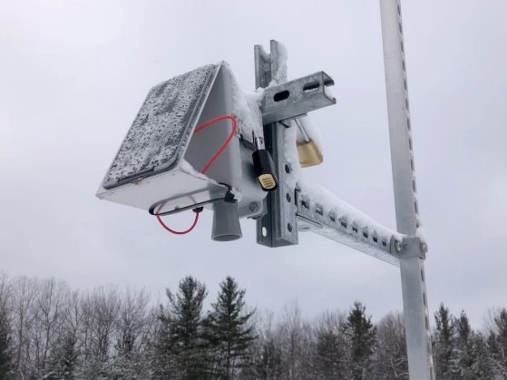
Snowpack Dashboard
How deep is the snow at the field station in northern Michigan? Access live, hourly data each winter from a snowpack sensor, which scientists monitor to analyze changes in winter, forest health and water quality in order to get a deeper understanding of the complexities of global environmental change. The setup uses a sonic rangefinder to monitor the distance between the bottom of the sensor and the ground beneath it. As snow accumulates, that distance will decrease — giving the snow-depth data.

Air Quality Sensor
How clean is the air outside in northern Michigan? The University of Michigan Biological Station is arming the public with information to make decisions about their health, such as whether to go outside for a jog. Access real-time data from the UMBS Air Quality Sensor, which is installed near the base of the UMBS AmeriFlux tower. The small device measures fine particulate matter — known as PM2.5 — emitted by wildfires and other pollutant sources and uses WiFi to share that information on a publicly available online map. The sensor gives our scientists and neighbors along Douglas Lake and Burt Lake the ability to assess the concentration of wildfire smoke and other pollutants, as well as the associated impact on our community and daily lives.