- News
-
- Research Preview: Dignity of Fragile Essential Work in a Pandemic
- Earl Lewis Awarded the National Humanities Medal by President Biden
- Earl Lewis Speaks on Reparations
- Young Speaks About Latest Book on Podcast
- Research
- Events
- News Features
- Staff Features
- In the Face of Resistance: Advancing Equity in Higher Education
- Greening the Road Ahead: Navigating Challenges for Just Transitions to Electric Vehicles
- In the Wake of Affirmative Action
- Center for Social Solutions Co-Produces 'The Cost of Inheritance'
- Press Release: Earl Lewis, University of Michigan, Receives the Roy Rosenzweig Distinguished Service Award from the Organization of American Historians
- Higher Admissions: The Rise, Decline, and Return of Standardized Testing
- Expanding Flood Monitoring Systems Across the Globe
- Events
This summer, the Center for Social Solutions continued its community-informed water monitoring placement efforts in collaboration with AIDD Labs in the College of Engineering. The RISE project has been ongoing for a year and has involved partners from the United States, Nepal, Malaysia, and South Africa. The long-term goal with this project is to collaborate with local communities to discuss the impacts of flooding on their lives, understand their monitoring needs, and assist with building the best solutions for the situation. This work aims to enhance existing networks in these regions , which are currently being managed by federal governments and/or nonprofits. With this enhanced network, we can assist with modeling the true extent of flooding and also build towards better anticipation of potential disasters.
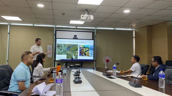
Our work this summer began in Nepal, where we held high-level discussions in Kathmandu with the National Disaster Risk Reduction and Management Authority (NDRRMA) and the Department of Hydrology and Meteorology (DHM). At NDDRMA, we met with the new head of the agency, who explained their need for water level data to inform their disaster response and recovery efforts. At DHM, they discussed the need for innovative methods to densify and expand their monitoring network. Recently, they have been assisting with the installation of pillars featuring water level markers to promote community awareness and engaging with citizens to collect water heights based on their personal experiences. These low-cost efforts have helped fill in gaps in water monitoring coverage. Our time in Kathmandu was capped off by a meeting (and BBQ!) with our partners at Kathmandu Living Labs (KLL) to discuss platform development for housing our expanding work in a way that allows us to share it easily and openly with the public and other partners.
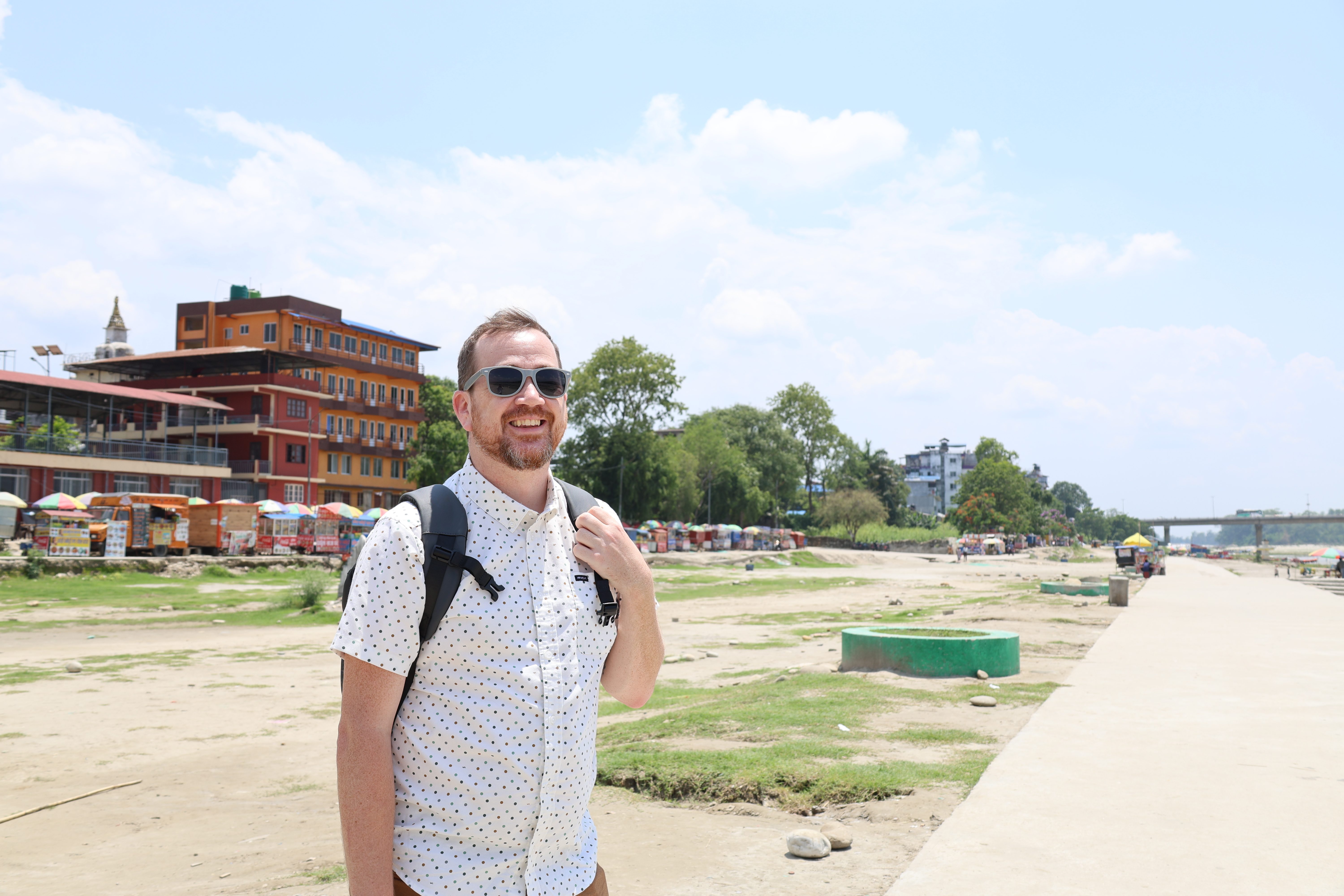
From Kathmandu, we drove to Bharatpur, Chitwan, the focus area of our work in the region, located in southern Nepal. Here, we collaborated with our local partner, the Institute for Social and Environmental Research-Nepal (ISER-N), to speak with local citizens who have been affected by flooding, to understand their experiences and needs. We spoke with many members who have had their business functionality interrupted, particularly those in the restaurant and hotel industries. We also heard a harrowing tale where a family had to abandon their livestock because the storm waters came on too quickly for them to release the animals from their pens. This event cost the family severely as the livestock was a vital part of their economic well-being. Typically, the storm waters would swell slowly and predictably, giving the family enough time to know when they should evacuate (usually after the floodwaters reached knee-deep). However, with climate change increasing the volatility of storms, the storm that came late last year took the community by surprise, even though they had lived with floodwaters for a long time and had a good understanding of their movements. Understanding the need, we collaborated with the community to identify a suitable location for installing a real-time water level sensor, enabling us to provide them with valuable information to inform future decision-making.
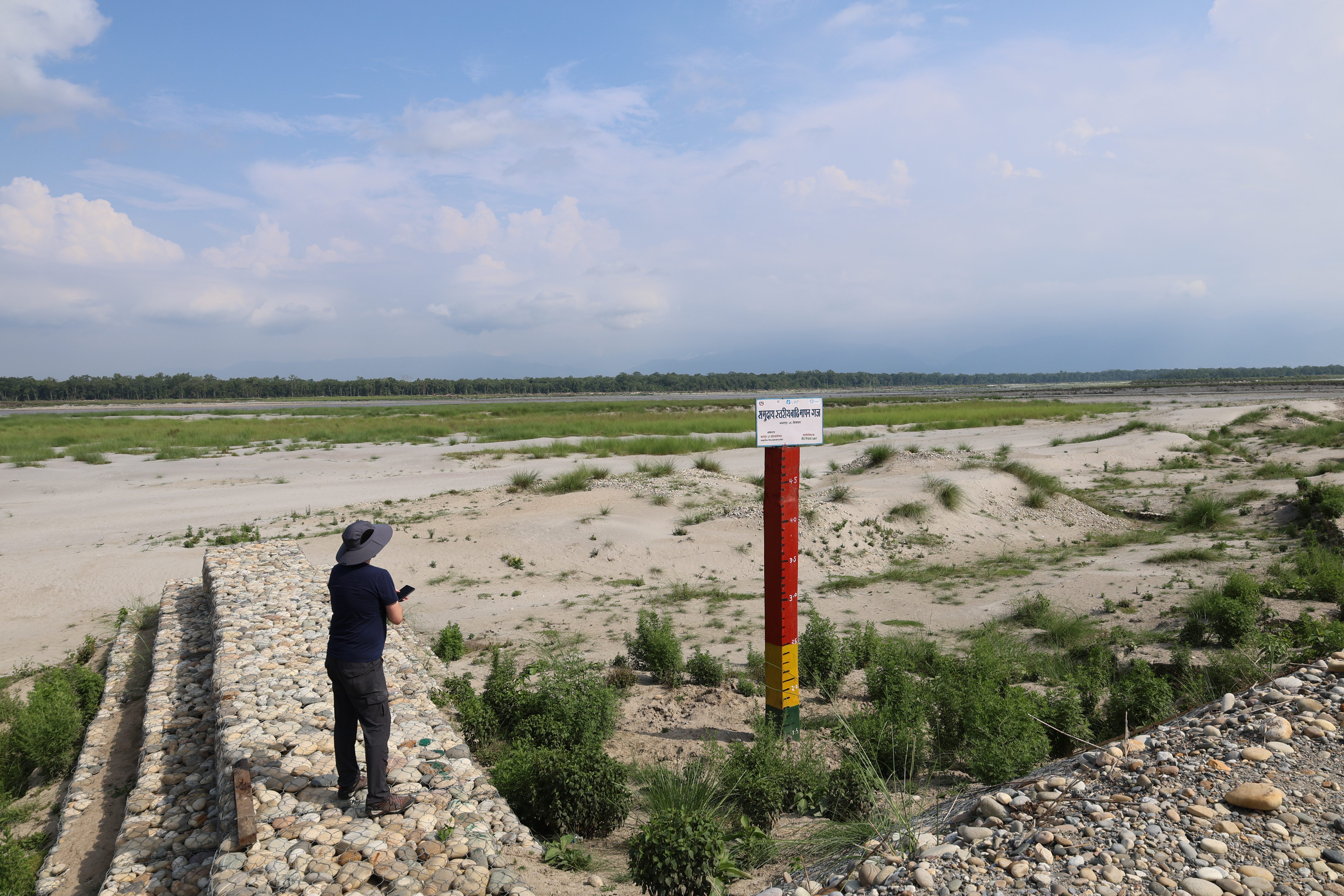
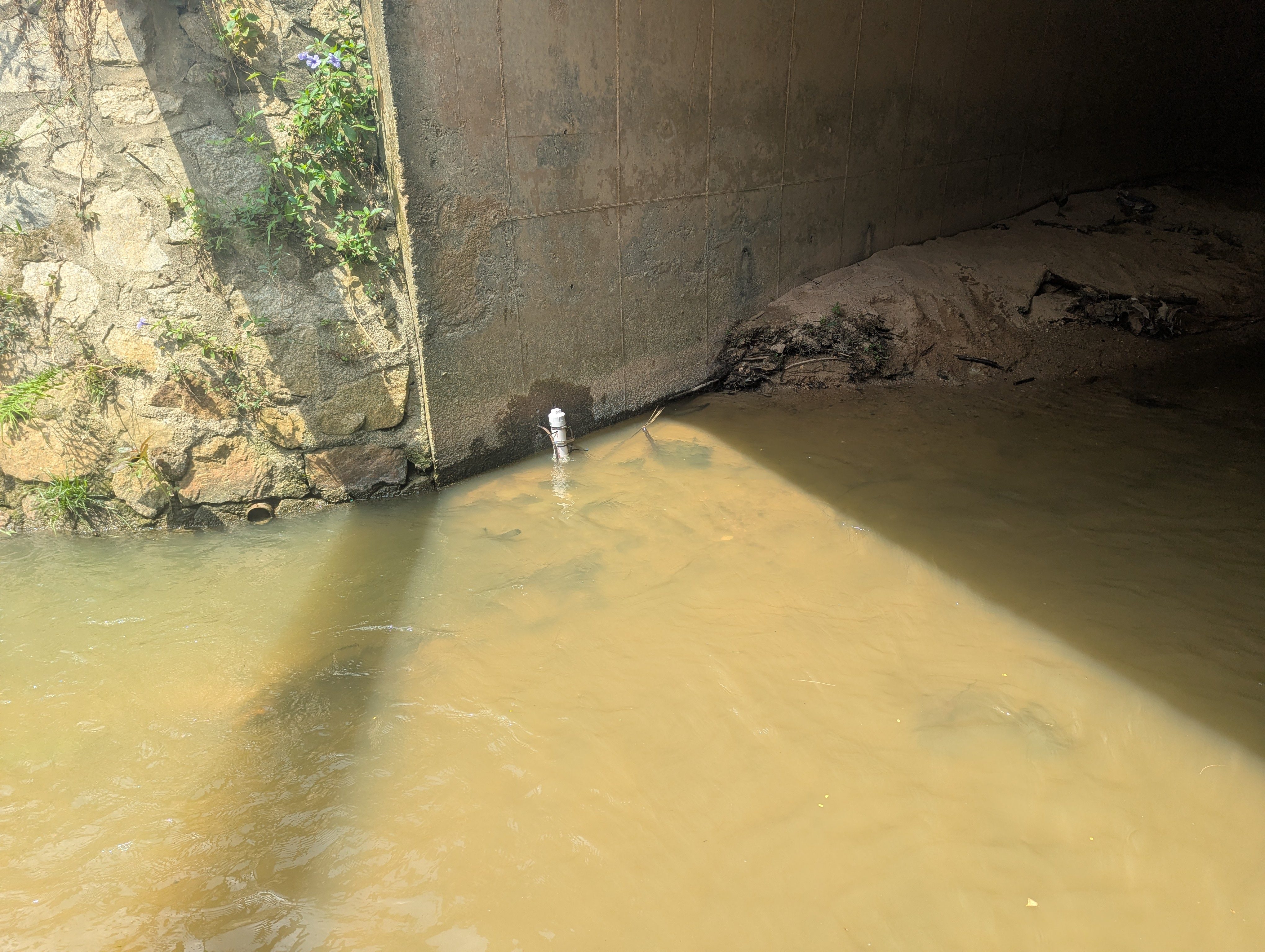
In addition to the real-time sensor placed near the home, we placed a real-time sensor on a pillar installed by DHM and a local non-profit organization that was created to show local citizens warning levels as water rises. DHM is collaborating with the Narayani River Management Project and other stakeholders to implement numerous mitigation efforts in the region. With our new sensor installed on top of the existing pillar, we can provide real-time data to the community and DHM, helping to address future needs in this area. We also deployed four additional sensors in the region in areas where current monitoring networks had gaps in coverage. These will help us understand the complex water mechanics ongoing in the area and will help inform future placement of monitoring networks. All the information we collect will be shared with local communities and federal agencies working in the region.
From Nepal, we continued to Malaysia to work with our partners at the University of Nottingham Malaysia. Malaysia is a rapidly developing country, which has led to numerous significant changes in land cover and land use. These rapid changes, paired with more intense and prolonged monsoon periods, have led to increasingly higher flood risks for citizens. During our visit, we spent time in the Taman Tasik Seminyih (TTS) community discussing with them the impacts of these land cover changes and how flooding has impacted their well-being. We also spent time exploring the geographies of the Gabai and Lui rivers, which are part of the larger Langat river basin.
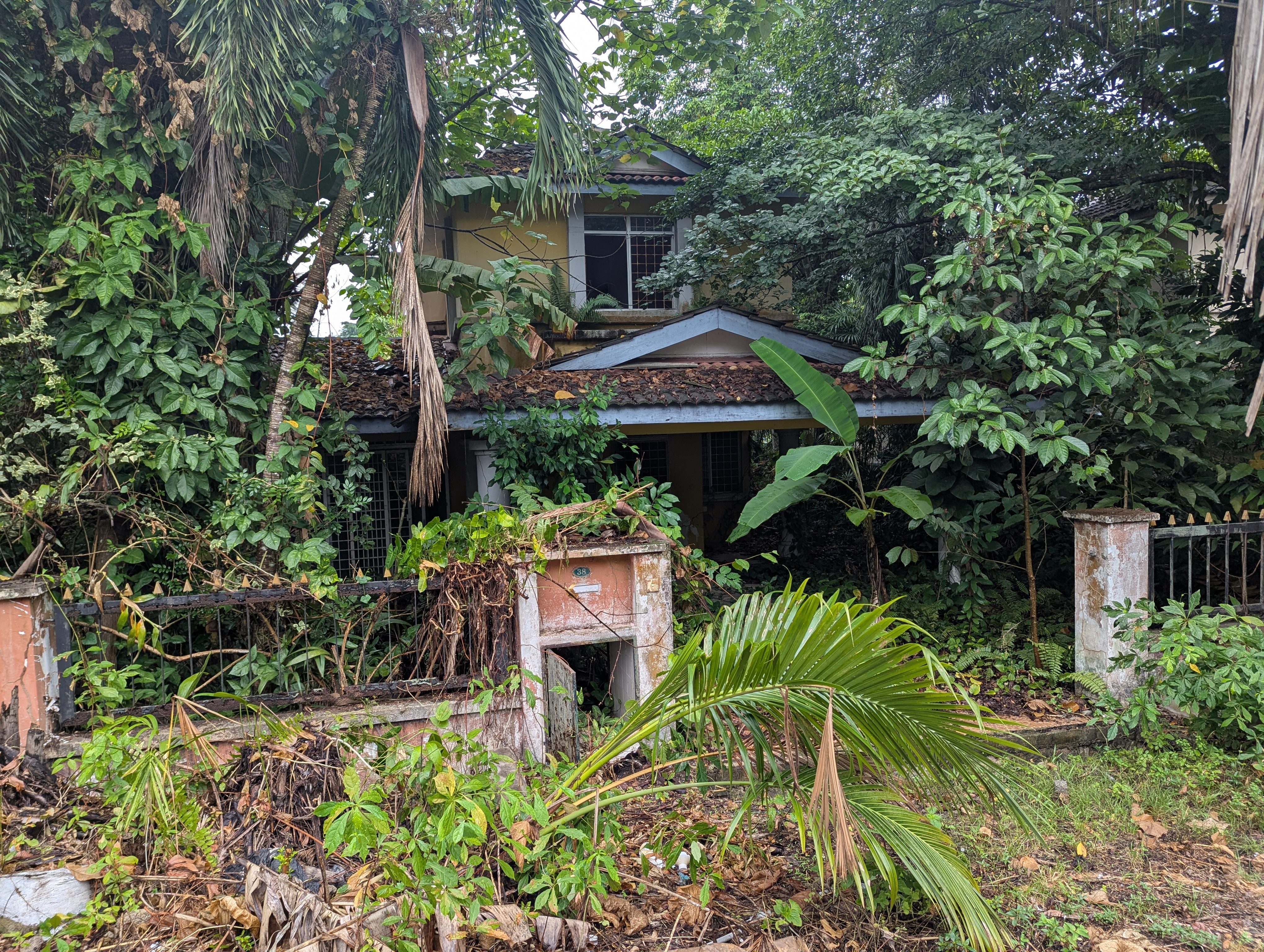
In TTS, we spoke with several community members about their experiences with flooding over the past few years. They discussed recurring nuisance flooding that has affected their ability to sell homes and maintain their value. Several homes near the waterways were observed to be abandoned, possibly due to the difficulty in selling them. This area is surrounded by hills that are seeing massive levels of development, potentially contributing to increased water flow into the TTS community. While some of the flooding is caused by the river that has been channelized through TTS, other flooding is caused by runoff in heavily paved areas, as well as by the overtopping of floodwater infrastructure. In collaboration with the community, we installed a real-time sensor at the point where the river enters the community, as well as two additional sensors where overtopping of infrastructure occurs and where the river exits the community. This provides a more holistic view of water dynamics for TTS.
Overall, we deployed four real-time sensors in critical locations with assistance and input from the communities we were working with. In addition, we deployed seven data loggers that collect water level information that would otherwise need to be collected manually from the device. These will provide critical information for future work in these areas. We learned a tremendous amount of information about how floodwaters were impacting Nepal and Malaysia, information that could not have been discovered by spending long periods both working in and living in the communities. At CSS, we continue to work with our partners, learning from each other, and building towards solutions that impact direct problems voiced by the communities we serve. The future of flood risk reduction starts where data meets lived experience.