This project seeks to provide data and information to decision-makers and community leaders so they can more accurately understand and depict the burden their community members face amid rampant climate change effects on weather patterns.
This information will be presented via a composite index of the difficulty a given household faces in responding to and recovering from a flooding event. The index will have strong representation of neighborhood context due to diverse and multi-resolution data sources.
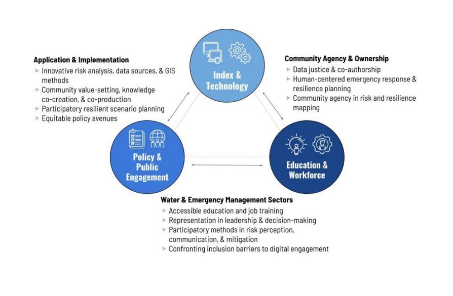
This five-county FRAI prototype advances novel geospatial methods, offers opportunity for community-co-production, and allows for temporal analysis in ways other national vulnerability indices do not. We are continuing to refine these methods and foster qualitative and participatory engagement with the index, as well as explore access points for inclusion and representation in emergency management and water sectors. The model will be used to guide more equitable (as federally mandated by the Stafford Act) flood response and recovery efforts and equip communities with agency over their flood risk and resilience.