Blog Post: Searching for clues to ancient landscape change in central Arizona
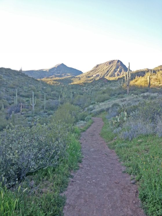
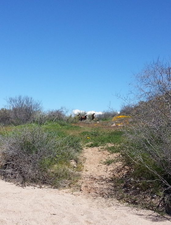
In a wash east of Phoenix, Arizona, we make our way downsection and deeper in time. Wild horses watch as we pass through cholla and wildflowers. We’re looking for a geological boundary that marks the absence of time, an unconformity caused by erosion. A similar contact is present in the Grand Canyon 260 miles to the northwest, where Cambrian Tapeats Sandstone overlies 1.7 billion-year-old Vishnu Schist. In central Arizona, this gap in time is more pronounced—roughly 500 million years longer—than the Great Unconformity in the Grand Canyon. In order to erode so much of a region’s geological history, tectonic forces must significantly transform the landscape by building and destroying mountains. We have come to central Arizona to look for evidence of collapsing mountain ranges and changing landscapes that occurred over 30 million years ago.
We are geologists who are part of a group working to piece together this history of tectonism and landscape change. Representing the group on this trip is William Holt (a geophysicist), E. Troy Rasbury (a geochronologist), and Dan Davis (a structural geologist) from Stony Brook University in New York and Saad Haq (a structural geologist) from Purdue University in Indiana. I am a paleontologist from the University of Michigan specializing in stratigraphy and paleoenvironments. We are part of a project funded by the National Science Foundation aimed at reconstructing and understanding the connections between the tectonic, climatic, and paleontologic history of western North America over the past 36 million years.
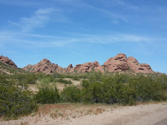
The tectonics of western North America changed substantially over the Cenozoic. During the Mesozoic and early Cenozoic, the western margin of North America was a subduction zone, and compressional tectonics built thick crust and high mountain ranges in what is now Nevada and Arizona. Beginning in the late Cenozoic, the margin became a transform boundary, and the mountain ranges began to collapse through widespread extension. This extension resulted in the present-day Basin and Range, which is characterized by north-south trending mountain ranges separated by valleys. Metamorphic core complexes are one of the indicators of extension, as these rocks from the deep crust are exposed during faulting. In central Arizona, several core complexes on the eastern edge of the Basin and Range mark the rough extent of the “Mogollon highlands” that collapsed during this phase of extension.
Along with core complexes, sedimentary deposits are also important indicators of landscape change. Reading rock layers and the gaps between them allows us to interpret the history of ancient landscapes: if mountains are pushed up, sediments erode and unconformities are created; if basins subside, sediments accumulate and layers stack up. Sediment eroded from uplifted areas is shed into adjacent basins. The Cenozoic deposits overlying the Proterozoic basement represent the sediments shed from the highlands as they were collapsing.
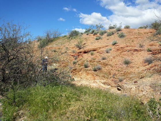
North of Phoenix, in an unassuming gully beside the highway, we find the unconformity. Here, Proterozoic schist is overlain by beds of red-colored conglomerate that represent river channels that drained the Mogollon highlands as they collapsed roughly 25 million years ago. Gavin McCullough, a paleontologist at the Arizona Museum of Natural History, has taken us here because several meters above the unconformity, some of the oldest Cenozoic mammal fossils in Arizona are found in layers of sandstone and volcanic tuff. These mammal fossils provide biochronologic constraints on the age of the sediments eroding off the Mogollon highlands. One of the goals of our project is to sample volcanic tuff layers that are interbedded with fossiliferous sediments for radiometric dating. Absolute dates on the fossiliferous sediments will provide higher-precision estimates for the timing of landscape collapse, refine the ages of the mammal faunas of the region, and will help correlate these beds with other Cenozoic deposits scattered around the Phoenix area.
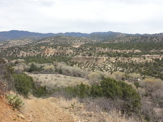
From Phoenix, where the core complexes and sediments record the early stages of faulting and extension, we traveled north to Prescott to see evidence of a different stage in the history of collapse. In the evocative Skull Valley, Jeb Bevers, a paleontologist from Yavapai College, took us to see more fossil-bearing deposits. These sandstone and mudstone beds represent a much later time in Arizona history and formed in lower-energy rivers and floodplains that were home to several species of camels, horses, and dogs that lived between 14 and 9 million years ago. Here, too, layers of tuff are interbedded with the fossiliferous sediments. Tuff samples from these deposits will also provide valuable dates for the ages of the faunas that lived in the region during and following the height of Basin and Range extension.
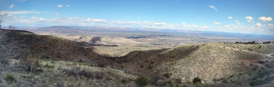
On another day, we drove over the Black Hills to look across the Verde Valley to the edge of the Colorado Plateau. The Verde Valley is floored by late Cenozoic lacustrine sediments deposited less than 8 million years ago during the late stages of Basin and Range development. By this time, the Mogollon highlands had been eroded and the landscape dissected by extension. In Arizona, as in Nevada, California, Utah, New Mexico, and northern Mexico, landscapes dominated by high mountains had changed to landscapes dominated by numerous lake basins bounded by smaller ranges in less than 20 million years. Over the course of a week, we were able to see snapshots of this transformation in the places we visited in a relatively small geographic area. The geologic history of central Arizona is representative of the tectonic reorganization and landscape change that occurred over much of western North America during the Cenozoic. Our trip helped us gain perspective on the timing and spatial extent of the collapse of the Mogollon highlands and associated landscape change. When we return to continue our work, we will have new dates to add to the geologic and paleontologic context that will help us understand how the tectonic, sedimentologic, and paleontologic histories of the region influenced one another.